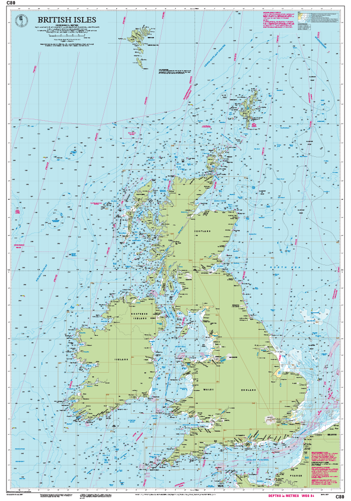
This edition of the C51 paper chart is printed and corrected to September 2015.
Digitally printed on water resistant paper & folded to A4 size in a plastic wallet – open size: 79 x 112cm
Chart scale 1:145 000
WGS 84
MCA recognised
Detailed cartography using up-to-date official survey data, with the latest depth surveys applied
Contains tidal stream information including direction and rates. Includes a separate sheet of information with any symbols & abbreviations used on Imray charts.
The chart specification has been improved to show coloured light flashes
Latest chart corrections available on the Imray website
Plans included:
Pwllheli
Aberdovey
Aberystwyth
Aberaeron
New Quay
Aberporth
Cardigan
Newport Bay
Fishguard
Entrance to Milford Haven